Ethnography · Escalera
Juniper chozones of Escalera: El Cerrillo and El Sabinar
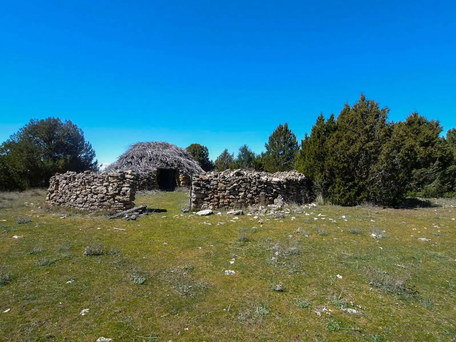
Spanish juniper chozones are pastoral folds of generally circular plan, built with limestone and timber of Juniperus thurifera, thatched with a woody juniper layer called barda, used until recent decades for sheep and goats. In Escalera, a park trail visits two clusters: El Cerrillo and El Sabinar.
Lands and landscapes
From here, follow the memory of the territory
These readings connect Juniper chozones of Escalera: El Cerrillo and El Sabinar with the history, work, and villages around it.
This place across time
Which eras you can read here
A single place can preserve traces from different eras. These layers connect what you see with the stories in the atlas.
- Municipality
- Escalera
- Province
- Guadalajara
- Altitude
- 1,221 m
- Spanish juniper
- Barda thatched roof
- Ethnographic route
- El Cerrillo and El Sabinar
Not ordinary sheepfolds
Chozones are related to generic sheepfolds (parideras), but represent a distinct architectural type. Nor are they tainas (which feature grass sod roofs) or simple open tenadas. A chozón is constructed exclusively with limestone masonry and an internal structural framework of Spanish juniper (Juniperus thurifera), capped with an insulating layer of woody juniper branches called barda.
The trail
The Natural Park has signposted two dedicated ethnographic trails for chozones. The Escalera route visits two distinct clusters, El Cerrillo and El Sabinar: this is Ruta Etnográfica 2. To understand their construction techniques in detail, visit also the Chozón Museum in Ablanque.
Location
● Reference point · ● Villages · ● Places
Location diagram. Detailed map with tracks and names loads on zoom.
Reference villages: Escalera · Lebrancón · Fuembellida · Valhermoso.
Open the full map and historical layers →