Alto Tajo and headwaters · memory of the water
Linares or Salado: Casares, Los Milagros and salt works
From Cueva de la Hoz to the Ablanquejo: the Linares or Salado carves the Valle de los Milagros and passes Casares cave and the salt pans of Saelices.
Also known as: río Linares, río Salado.
- Headwaters
- Santa María del Espino sector, near Cueva de la Hoz.
- downstream
- Ablanquejo; thereafter, Tagus.
Linares · SaladoAblanquejoTajo
Fed by this network
Sources alternately call this watercourse Linares or Salado. It rises near Santa María del Espino, where Cueva de la Hoz contains some two hundred Upper Palaeolithic engravings discovered by Juan Cabré in 1933.
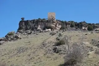
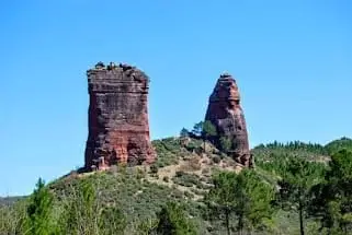
Riba de Saelices lies along its fertile valley, marking the boundary between the Alcarria and the Señorío de Molina. Here the river carved the dramatic Valle de los Milagros through limestone, sandstone, and slate between the towers of Puntal del Milagro and Peña Eslabrada.
Saelices de la Sal embodies its salt heritage in its name. Its San Juan salt works, recorded since 1203, preserve wells, waterwheels, evaporation terraces, brine pools, a warehouse, and a chapel, with standing structures from the 18th century.
Memory we can follow
Paleolithic – later prehistory
Earliest artistic expressions
In Cueva de los Casares, Neanderthals and modern humans inhabited the cave during different eras. Upper Palaeolithic engravings date from between 30,000 and 11,000 years ago.
Read the story →12th – 20th centuries
The engineering of salt
At Saelices de la Sal, historic brine extraction machinery demonstrates how communities produced salt hundreds of kilometres from the sea.
Read the story →1936 – 1939 and the postwar years
The silent concrete bunker
A triangular concrete machine-gun bunker still stands in Saelices de la Sal, built during the 1938 Forgotten Battle but reportedly never fired in combat.
Read the story →Villages to read this basin from
These are gateways to its headwaters, valleys, and memory. The selection gathers regional villages; it does not imply the entire municipality drains into this river.
Traces of the river and its basin
Lands united by water
Sources of this reading
- DOCM, 19 de febrero de 2025: nombres y conexiones de los cauces
- JCCM: Ley de declaración del parque, zona del Salado o Linares y arroyo de la Vega
Linked memory stories include their own cited sources. Fluvial connections refer to this specific stream; names like Salado and Tajuelo also recur in other basins.