Village · Guadalajara · 1,183 m
Santa María del Espino
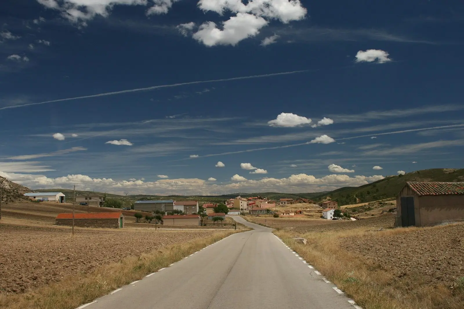
Santa María del Espino is a settlement in Anguita municipality near the Tajuña valley. Around 2 km away is La Hoz cave, with some two hundred Upper Palaeolithic engravings, discovered by Juan Cabré in 1933 and listed as an Asset of Cultural Interest, closed to the public for protection. Anguita municipality reaches the area’s highest point, Otero hill (1,321 m), inside Alto Tajo Natural Park.
Rivers and basins
The thread of water from Santa María del Espino
Follow these watercourses towards their confluences, villages, and basin history.
Traces in the village and its surroundings
Which eras you can read here
A single place can preserve traces from different eras. These layers connect what you see with the stories in the atlas.
1936–1939 · memory of the territory
The war in the village memory
The war also reached the work of the pine woods. Among LURE’s resin workers called up for military service were one worker from this village. Their story connects the memory of the woods with those who had to leave their trade during the conflict.
Source: Berlanga, capítulo 9, pp. 346–347.
Read the story of the river frontline →What to see in Santa María del Espino
- Cueva de la Hoz, about two kilometres away, with some two hundred engravings from the Upper Paleolithic. It is a declared Cultural Heritage Asset (BIC) and is closed to the public to protect it.
A hamlet of Anguita
Santa María del Espino is one of the settlements in the municipality of Anguita, alongside Aguilar de Anguita, Padilla del Ducado, and Villarejo de Medina. Very close by is Cerro del Otero, at 1,321 metres, the highest point in the municipal territory, which belongs to the Alto Tajo Natural Park.
Nearby
Luzón, about six kilometres away, with the gorges of the Tajuña and La Cava, and Cueva de los Casares in Riba de Saelices, which can be visited.
Places in and around Santa María del Espino
Near Santa María del Espino
Castro de Hocincavero (Anguita)
AnguitaTajuña gorges: 11 km of river between Anguita and Luzón
Anguita
La Cava (Luzón): a Celtiberian town above the Tajuña
LuzónFossil waves of Padilla del Ducado: a 240-million-year-old seabed
Anguita
Cueva de los Casares: Paleolithic art, Neanderthals, and Islamic tower
Riba de SaelicesRiba de Saelices watchtower: the Berber tower above Los Casares cave
Riba de SaelicesTorre de la Cigüeña: The Watchtower Over Anguita and the Tajuña
AnguitaLuzón School Museum: the 1950s classroom
LuzónSanta María del Espino has no separate census: its residents are recorded under the municipality of Anguita.
Climate in Santa María del Espino month by month
2015–2024 averages from Copernicus ERA5 reanalysis for an altitude of approx. 1,183 m. Useful for planning, not a substitute for live forecasts.
Location
● Reference point · ● Villages · ● Places
Location diagram. Detailed map with tracks and names loads on zoom.
Reference villages: Anguita · Luzón · Riba de Saelices · Saelices de la Sal.
Open the full map and historical layers →