Protected area
Tetas de Viana: The Twin Hills of Trillo
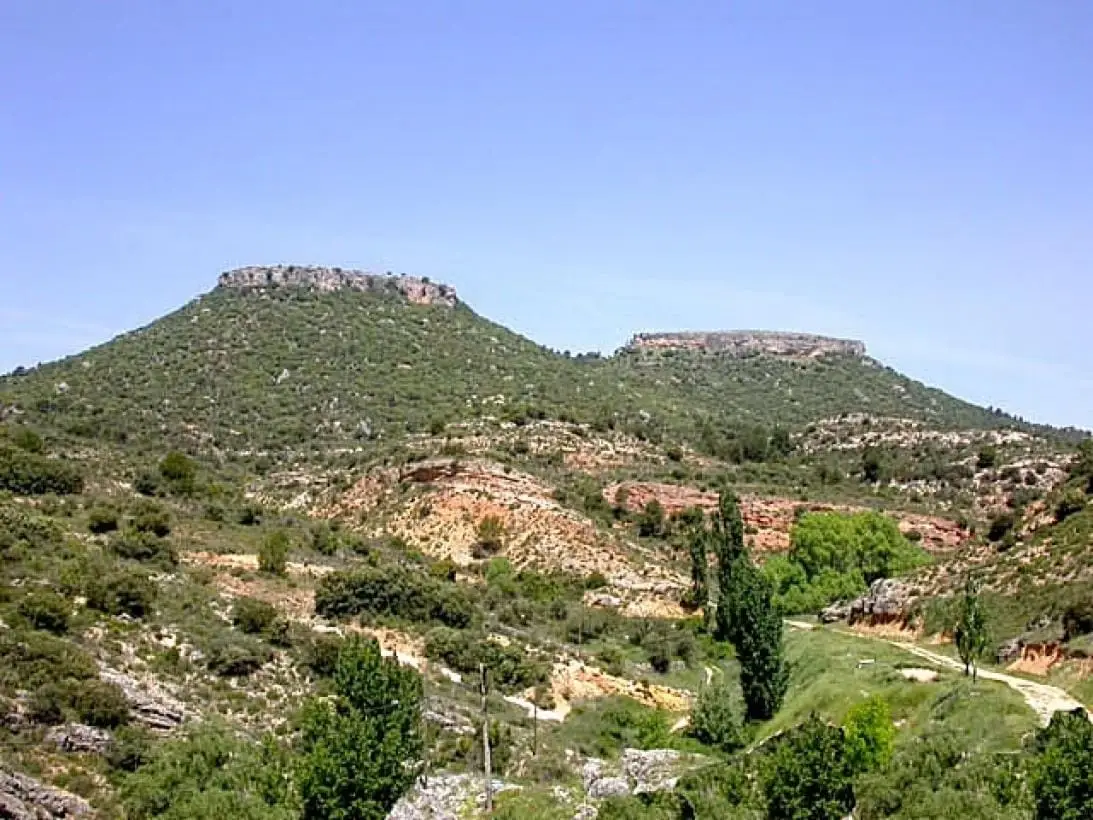
The Tetas de Viana are two twin flat-topped buttes of clay capped by 20 to 30-metre limestone layers, eroded by the Tagus, the Solana river, and several seasonal ravines. Their sheer vertical cliffs make them almost inaccessible; only the southern butte is climbed via iron stairs that replaced older stone steps leading to a medieval watchtower.
- Altitude
- 1,061 m
- Witness buttes
- Iron stairs
- Ancient watchtower
- Outside the Natural Park
Twin witness hills
A witness hill (cerro testigo) is the remnant of an ancient elevated plateau left standing after erosion has carved away the surrounding landscape. Soft clay layers are protected above by resistant limestone caprocks. Here, two nearly identical flat summits rise prominently above the surrounding plains.
Climbing the southern summit
Ascending the southern butte is possible via a steep pathway culminating in an iron stairway installed through a narrow cliff fissure. The flat summit offers sweeping 360-degree views across the La Alcarria transition into Alto Tajo.
Location
● Reference point · ● Villages · ● Places
Location diagram. Detailed map with tracks and names loads on zoom.
Reference villages: Trillo · Carrascosa de Tajo · Peralveche · Arbeteta.
Open the full map and historical layers →Nearby routes
All routes →Trail 3: Rambla del Avellano (Arbeteta)
10 km · 4 h · Circular
Trail 2: Senda del Castillo of Valtablado del Río
8.9 km · 5 h · Circular