Waterfall · Peralejos de las Truchas
Cascada del Molino de Arriba (Peralejos de las Truchas)
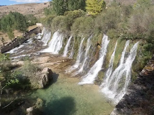
The Molino de Arriba waterfall is a drop on the Tagus formed by an ancient, disused weir roughly 2 km along an unpaved track from Peralejos de las Truchas. The falling water carves a deep plunge pool beneath calm emerald-green upstream backwaters.
Lands and landscapes
From here, follow the memory of the territory
These readings connect Cascada del Molino de Arriba (Peralejos de las Truchas) with the history, work, and villages around it.
- Best season
- Spring, with higher flow
- Municipality
- Peralejos de las Truchas
- Province
- Guadalajara
- Altitude
- 1,169 m
- Naturalised weir drop
- Deep plunge pool
- 2 km unpaved track
- Small parking area
A weir reclaimed by the river
The cascade originated from a man-made dam weir, long disused, which river erosion has broken down and colonised with vegetation. Upstream, the Tagus expands into a serene pool of emerald and aquamarine hues; below, it plunges with force into a deep natural pool.
How to get there
From the frontón court in Peralejos, follow a well-maintained unpaved dirt track. In about two kilometres you reach the upper section of the waterfall, where parking exists for about fifteen cars beside a former hostel. Marked trails depart from this spot.
Practical advice
During summer it sees high visitation; for peace and quiet, arrive early in the morning or visit outside peak months. Respect Park signage.
Location
● Reference point · ● Villages · ● Places
Location diagram. Detailed map with tracks and names loads on zoom.
Reference villages: Peralejos de las Truchas · Masegosa · Megina · Chequilla.
Open the full map and historical layers →