Heritage · Peñalen
Peñalén Bridge or Puente del Tío Lucas: a 1943 crossing between rock fins
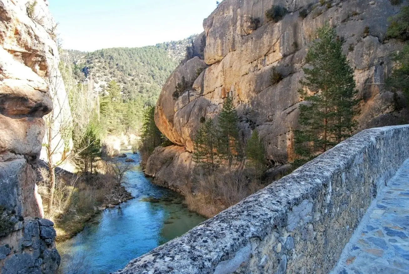
The Peñalén bridge sits about six kilometres from the village, near the Tagus and Cabrillas confluence, between rows of vertical rock fins. It looks medieval, but an inscription dates it to 1943. Narrow and built for people and pack animals heading across ridges to Molina. Also known as Puente del Tío Lucas, after its builder.
Lands and landscapes
From here, follow the memory of the territory
These readings connect Peñalén Bridge or Puente del Tío Lucas: a 1943 crossing between rock fins with the history, work, and villages around it.
This place across time
Which eras you can read here
A single place can preserve traces from different eras. These layers connect what you see with the stories in the atlas.
- Municipality
- Peñalen
- Province
- Guadalajara
- Altitude
- 1,042 m
- 1943
- Puente del Tío Lucas
- Rock fins
- Tagus-Cabrillas confluence
Looks medieval, but is not
Many assume it is ancient, but an inscription dates it to 1943. It is also known as Puente del Tío Lucas, named after the man who built it.
For walkers and pack animals
It is narrow and was never intended for motor vehicles, but for foot travellers and livestock, who continued along rocky bridle paths toward Molina de Aragón and other mountain villages.
The setting
It sits in a striking gorge, with rows of vertical limestone fins cut through by the Tagus, close to its confluence with the Cabrillas, about six kilometres from Peñalén.
Location
● Reference point · ● Villages · ● Places
Location diagram. Detailed map with tracks and names loads on zoom.
Reference villages: Peñalen · Poveda de la Sierra · Taravilla · Baños de Tajo.
Open the full map and historical layers →