Route · Peralejos de las Truchas
Sendero 11: Trail 11: Barranco del Horcajo (Peralejos)
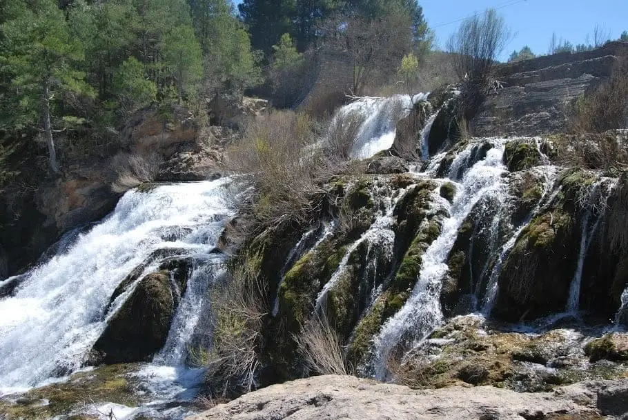
Circular trail of about 6.5 km and 3 hours, moderate difficulty, starting on the CM-2016 road 2 km from Puente del Martinete towards Tragacete. Crosses Hoyorredondo depression and descends Horcajo ravine with tufa, waterfalls, linden, yews, and butterworts.
Lands and landscapes
From here, follow the memory of the territory
These readings connect Trail 11: Barranco del Horcajo (Peralejos) with the history, work, and villages around it.
- Code
- Sendero 11
- Distance
- 6.5 km
- Elevation gain
- 281 m
- Duration
- 3 h
- Trail type
- Circular
- Difficulty
- Moderate
- Best season
- Autumn for the deer rut; spring for the ravine flora
- Altitude
- 1,167 m
Walking duration without transfers or stops. Difficulty rated according to the official source; verify its conditions and notices. “Easy” does not imply wheelchair or stroller accessibility.
- Sendero 11
- Circular, moderate difficulty
- Linden, yews, butterworts
- Autumn deer rut
- Formerly RG PNAT 10
Starting point
At a curve on the CM-2016 road, about 2 km from Puente del Martinete towards Tragacete, past the trailhead sign there is a grassy area for parking. About 100 m ahead the loop begins: heading towards the ravine, it is walked clockwise (the recommended direction). Located in Peralejos de las Truchas.
Hoyorredondo and the ravine
First, Scots pine with maples, gall oaks, and barberries; at the saddle continue straight without deviating towards Cueva del Hierro. The depression of Hoyorredondo is a pasture area where, at dawn and dusk in early autumn, the rutting calls of red deer and fallow deer can be heard. Then a narrow path descends for 2 km through Barranco del Horcajo: limestone walls, tufa, small cascades, and a grove of linden, hazel, whitebeam, maple, and yew trees, with butterworts (carnivorous plants) on moist rock faces. After a steep climb you reach views of the Tagus, returning through shaded pine woods.
Bring binoculars
On the cliffs you can spot griffon vultures, peregrine falcons, golden eagles, Egyptian vultures, and blue rock thrushes; occasionally Spanish ibex.
Before you set out
Carry water, mountain footwear, and download the GPS track in advance: mobile reception is absent in many areas. Check the forecast on Today in the Alto Tajo and the official trail sheet for notices and closures, and respect seasonal restrictions during raptor breeding periods.
Official route · Parque Natural del Alto Tajo (Junta de Castilla-La Mancha). Description, track and notices on the official guide. Before setting out, verify there whether changes or closures apply.
Location
● Reference point · ● Villages · ● Places · ━ Simplified official route
Location diagram. Detailed map with tracks and names loads on zoom.
Reference villages: Peralejos de las Truchas · Cueva del Hierro · Masegosa · Poveda de la Sierra.
Open the full map and historical layers →