Castle · Villel de Mesa
Castle of Villel de Mesa: the rock fortress of the Funes
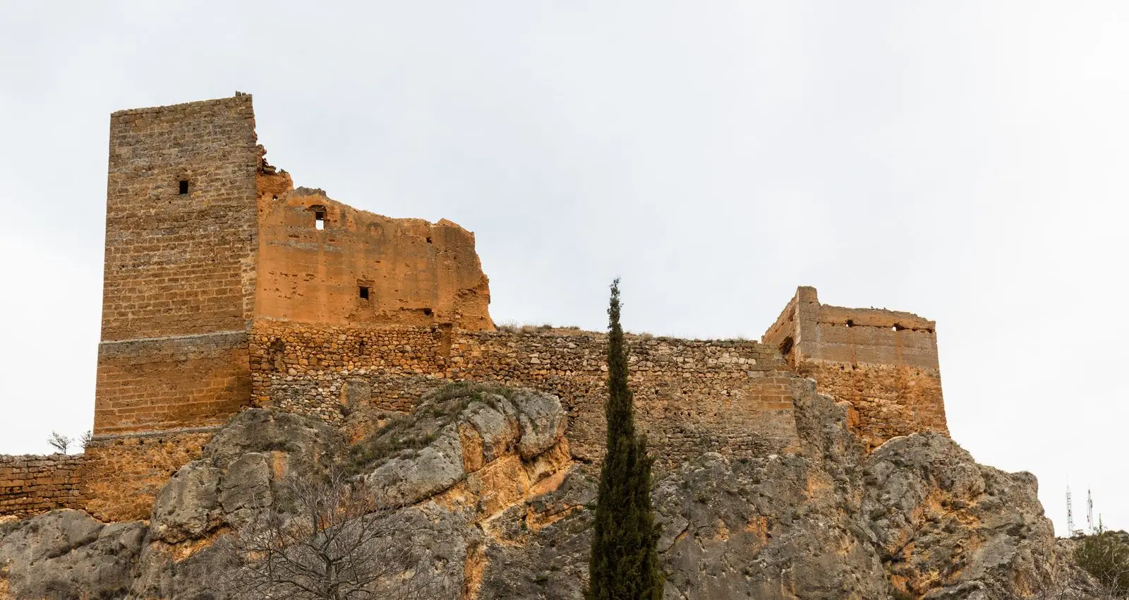
The castle of Villel de Mesa, or Castle of the Funes, is a rock fortress built atop an elongated crag with 40-metre vertical cliff faces in the narrow Mesa valley. Its origin is debated: it may have been Muslim or 13th-century Christian when the Mesa valley served as the border between Castile and Aragon. It is named after the Navarrese lineage that held it for centuries.
This place across time
Which eras you can read here
A single place can preserve traces from different eras. These layers connect what you see with the stories in the atlas.
- Municipality
- Villel de Mesa
- Province
- Guadalajara
- Altitude
- 948 m
- Rock fortress
- Mesa valley
- Funes lineage
- Border
Upon the sheer rock
In the valley of the Mesa River, the castle of Villel de Mesa conforms entirely to the natural limestone ridge supporting it: an elongated rock crest flanked by vertical drops of some forty metres. It represents a textbook example of a rock fortress (castillo roquero). Its ground plan is simple and rectangular, roughly forty metres in length, aligned north to south.
A debated origin
The identity of its original builders remains debated. One hypothesis suggests an early Muslim fortress subsequently modified and expanded by Christian forces. Another attributes its origin to the 13th-century Christian reconquest, when the Mesa valley was an active frontier between Castile and Aragon subject to repeated skirmishes. What is certain is that for centuries it was the seat of the Navarrese Funes noble lineage, who gave it their name.
The valley setting
The Mesa River forms here one of the most striking gorges in the Señorío. Downstream lies Pozo Galeano, and the Tormo de Mochales is located just a few kilometres away.
Location
● Reference point · ● Villages · ● Places
Location diagram. Detailed map with tracks and names loads on zoom.
Reference villages: Villel de Mesa · Algar de Mesa · Mochales · Amayas.
Open the full map and historical layers →