Water source · Taravilla
Laguna de Taravilla: an 11,000-year-old natural tufa dam
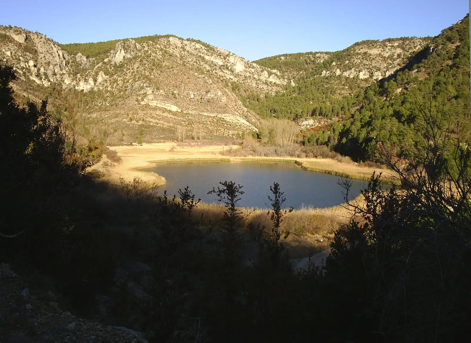
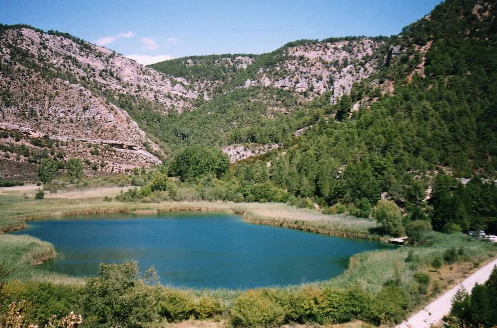
Laguna de Taravilla is an Alto Tajo lake dammed by a natural tufa barrier roughly 175 metres long and 30 metres high, formed around 11,000 years ago. Fed mainly by underground springs, its sediments preserve the climate record of the last two thousand years. Located a few kilometres from Salto de Poveda.
Lands and landscapes
From here, follow the memory of the territory
These readings connect Laguna de Taravilla: an 11,000-year-old natural tufa dam with the history, work, and villages around it.
This place across time
Which eras you can read here
A single place can preserve traces from different eras. These layers connect what you see with the stories in the atlas.
- Best season
- Spring and autumn
- Municipality
- Taravilla
- Province
- Guadalajara
- Altitude
- 1,125 m
- Tufa barrier
- Underground springs
- Climate record
- Georoute 7
- Near Salto de Poveda
A dam built by water
The lake occupies a hollow closed off by a tufa barrier: porous limestone that forms when lime-rich spring water releases its mineral load as it surfaces and tumbles. This natural dam measures roughly 175 metres long, 75 metres wide, and 30 metres high, which is why the water stays backed up instead of dropping straight into the Tagus. Only after heavy rains does the lake spill over the crest, forming a cascade.
The tufa and the plant remains trapped inside can be radiocarbon dated, showing that the barrier began forming about 11,000 years ago. Today it is largely dormant, except at one end during wet spells, but just two centuries ago it was a roaring, moss-covered waterfall, similar to nearby Salto de Poveda but entirely natural.
The mystery of its water level
For centuries, the rising and falling of the water inspired local legends. The explanation is underground: the lake receives little surface runoff from the stream and a great deal from springs located on its shores and deep on its bed. Time elapses between rainfall on the heights and water emerging in the lake, so the level seems to change on its own schedule.
A black box of past climate
Silt and clay have gathered on the lake bed, trapping pollen, mineral grains, and tiny fossils. These sediments work like an aircraft flight recorder: they preserve environmental changes of the last two thousand years and even allow scientists to estimate rainfall levels across recent centuries.
How to visit
It is reached from the village of Taravilla. Beside the lake stands an information panel for Georuta 7 of the Geopark, and from here the circular Sendero 10 route heads down toward Salto de Poveda.
Planning the visit
Allow half a day if combining it with the waterfall via Sendero 10; for a simple stop beside the lake, a shorter visit works well.
Before you go
The dirt track from Taravilla is not a paved town street. Check the parking area and road conditions before setting out; do not calculate driving time purely from straight-line distances.
Pairing your trip
Continue to Salto de Poveda. Check its page to see if it fits into the same outing.
Frequently asked questions
How was Laguna de Taravilla formed?
By the growth of a calcareous tufa barrier that dammed the stream, preventing it from draining directly into the Tagus. The barrier began forming about 11,000 years ago.
Why does its water level change without rain?
Because it is fed mainly by underground springs. Rainwater takes time to seep through and travel across the aquifer before reaching the lake, so water rises happen with a delay.
Can it be combined with Salto de Poveda?
Yes. The circular Sendero 10 trail, about 5 km and 2 hours, with riverside sections and footbridges that require care, links the lake with Salto de Poveda.
Location
● Reference point · ● Villages · ● Places
Location diagram. Detailed map with tracks and names loads on zoom.
Reference villages: Poveda de la Sierra · Taravilla · Baños de Tajo · Terzaga.
Open the full map and historical layers →