Route · Villanueva de Alcorón, Peñalen
Georuta 6: Geotrail 6: from Villanueva de Alcorón to Peñalén
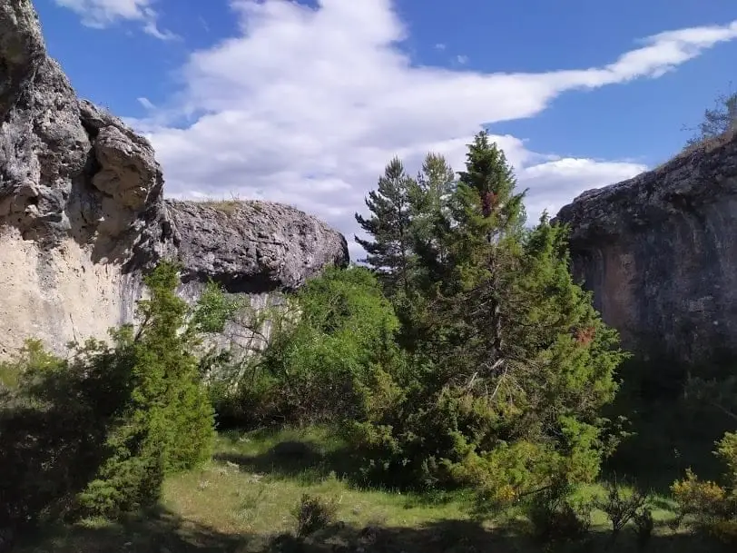
Georuta 6, around 22 km and 8 stops, illustrates the balance between resource use and conservation: Sima de Alcorón and Hoyo Redondo enchanted city on Peñalén paramera alongside abandoned quarries. By car or bike, with a 15-minute walk to Hoyo Redondo.
Lands and landscapes
From here, follow the memory of the territory
These readings connect Geotrail 6: from Villanueva de Alcorón to Peñalén with the history, work, and villages around it.
- Code
- Georuta 6
- Distance
- 22 km
- Duration
- 5 h
- Trail type
- Linear
- Difficulty
- Easy
- Altitude
- 1,330 m
Walking duration without transfers or stops. Check in the official source whether distance and time include the return leg. Difficulty rated according to the official source; verify its conditions and notices. “Easy” does not imply wheelchair or stroller accessibility.
- Georuta 6
- 8 stops
- Sima de Alcorón
- Hoyo Redondo enchanted city
How to travel the route
Georoutes are thematic itineraries with numbered stops, panels, and outcrop plaques, linked by car or bicycle, with certain sections on foot. The official self-guided brochure explains each stop.
The stops
- 1 and 2: the recreation area of Sima de Alcorón, via a track at km 5.2 on the road from Villanueva de Alcorón to Peñalén, and a plaque at the foot of the first flight of stairs into the chasm.
- 3 and 4: at Portillo de Peñalén, beside a stone cross, a track leads to parking; from there, 15 minutes on foot following trail markers to the enchanted rock city of Hoyo Redondo and a ruined corral. On the open paramera it is easy to become disoriented.
- 5 to 8: leaving Peñalén towards Poveda, and at abandoned stone quarries along the track descending to the Tagus, where the route ends.
Preservation and transformation
The georoute highlights landscape impacts: beside intact natural environments it visits sites transformed by stone quarrying, prompting reflection on sustainable stewardship.
Before you set out
Carry water, mountain footwear, and download the GPS track in advance: mobile reception is absent in many areas. Check the forecast on Today in the Alto Tajo and the official trail sheet for notices and closures, and respect seasonal restrictions during raptor breeding periods.
Official route · Parque Natural del Alto Tajo (Junta de Castilla-La Mancha). Description, track and notices on the official guide. Before setting out, verify there whether changes or closures apply.
Location
● Reference point · ● Villages · ● Places · ━ Simplified official route
Location diagram. Detailed map with tracks and names loads on zoom.
Reference villages: Villanueva de Alcorón · Zaorejas · Peñalen · Valsalobre.
Open the full map and historical layers →