Geosite · Checa
Checa Dropstone: a boulder dropped from an iceberg 440 million years ago
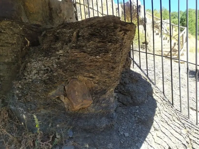
The Checa dropstone is an exotic boulder transported within glacial ice that dropped to the seafloor when the iceberg melted, becoming embedded in marine shale beds. It is a relic of the Lower Silurian glaciations, 444 to 428 million years ago, when this region formed part of the southern continent Gondwana. A prized geosite of the Geopark.
Lands and landscapes
From here, follow the memory of the territory
These readings connect Checa Dropstone: a boulder dropped from an iceberg 440 million years ago with the history, work, and villages around it.
This place across time
Which eras you can read here
A single place can preserve traces from different eras. These layers connect what you see with the stories in the atlas.
- Municipality
- Checa
- Province
- Guadalajara
- Altitude
- 1,372 m
- Silurian
- Glaciation
- Gondwana
- Marine shales
- Protected with railing
A boulder out of place
A dropstone is an isolated geological erratic dropped into bedded sediments. Glaciers calve icebergs that transport rocky debris out to sea. When an iceberg melts in the open ocean, it releases its rocky load, which plunges into fine seabed muds, often thousands of kilometres away from the source rock.
Ice from 440 million years ago
The specimen at Checa was deposited during the Lower Silurian glaciations, between 444 and 428 million years ago. At that epoch, this crustal block was part of the southern supercontinent Gondwana, near the South Pole. Today, the dropstone is preserved behind a protective iron railing within a natural outcrop of black shales near Checa, very close to the graptolite fossil site.
Location
● Reference point · ● Villages · ● Places
Location diagram. Detailed map with tracks and names loads on zoom.
Reference villages: Checa · Chequilla · Alcoroches · Orea.
Open the full map and historical layers →More geology and geosites nearby
View all →Checa Graptolites: Fossils That Look Like Writing
ChecaPoljé del Cubillo (Checa): a closed karst valley
Checa