Waterfall · Checa
The Aguaspeña of Checa: a living rock growing 4 cm a year
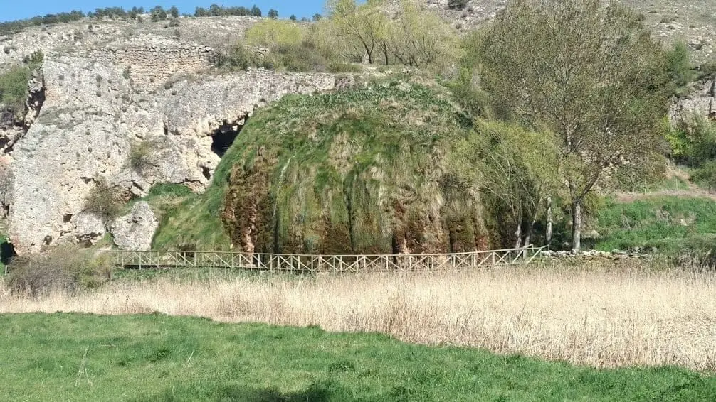
La Aguaspeña is a growing formation of calcareous tufa, around 2 km from Checa. Spring water deposits dissolved lime, building moss-covered walls, waterfalls and grottoes at around four centimetres a year. It is thought not to have existed two thousand years ago. Wooden walkways climb to the spring.
Lands and landscapes
From here, follow the memory of the territory
These readings connect The Aguaspeña of Checa: a living rock growing 4 cm a year with the history, work, and villages around it.
This place across time
Which eras you can read here
A single place can preserve traces from different eras. These layers connect what you see with the stories in the atlas.
- Best season
- Spring
- Municipality
- Checa
- Province
- Guadalajara
- Altitude
- 1,407 m
- Growing tufa
- Spring
- Walkways
- Geotrail 8
- Easy access
Watching rock being born
It is rare to see rock actively forming before your eyes. At La Aguaspeña you can: rainwater dissolves limestone across the highlands, moves underground, and as it emerges at the spring, releases its dissolved calcium carbonate. That mineral hardens over mosses and plants, building up a mass of calcareous tufa layer by layer.
The pace is remarkable for geology: roughly four centimetres each year. It is estimated that two thousand years ago La Aguaspeña did not even exist.
Active parts and dormant parts
One part of the formation continues to grow as water flows over it, forming small cascades and occasional rock collapses that the water gradually repairs. Another section is inactive because its old springs dried up or shifted course, leaving a vertical wall full of cavities and caves.
The visit
The site is fitted with wooden walkways and handrails running past the caves and up to the top of the waterfall and spring. It is a short and pleasant walk, especially in spring when the water flows with more force. It pairs naturally with a visit to the historic centre of Checa or with Georuta 8, which explains this and other features.
Planning the visit
It fits easily as a stop on a day exploring Checa and Chequilla. Use the walk to observe where the water deposits lime and how the tufa changes texture.
Before you go
Wet walkways can be slippery. Wear shoes with good grip, stay behind the railings, and do not step on the moss or surfaces where tufa is growing.
Pairing your trip
Continue to Checa. Check its page to see how it fits into your visit.
Frequently asked questions
How do you reach La Aguaspeña?
A paved track from Checa leads in around 2 km to the car park opposite the spring. Geopark Geotrail 8 also passes it.
What is calcareous tufa?
A porous rock formed when water carrying calcium carbonate emerges at a spring and deposits it, often on mosses and plants that become enclosed in the stone.
Location
● Reference point · ● Villages · ● Places
Location diagram. Detailed map with tracks and names loads on zoom.
Reference villages: Checa · Chequilla · Orea · Alcoroches.
Open the full map and historical layers →