Archaeological site · Checa
Castro de Castil-Griegos (Checa): Iron Age beside the Aguaspeña
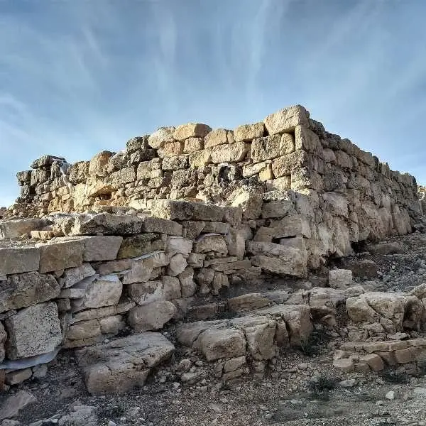
Castil-Griegos is an Iron Age hillfort perched on a hilltop in Checa, beside the Aguaspeña. It controlled the La Vega valley, one of the few natural passages traversing the Alto Tajo from north to south toward the Serranía de Cuenca, and is noted for the multi-phase defensive walls raised by its inhabitants.
Lands and landscapes
From here, follow the memory of the territory
These readings connect Castro de Castil-Griegos (Checa): Iron Age beside the Aguaspeña with the history, work, and villages around it.
This place across time
Which eras you can read here
A single place can preserve traces from different eras. These layers connect what you see with the stories in the atlas.
- Municipality
- Checa
- Province
- Guadalajara
- Altitude
- 1,417 m
- Iron Age
- Remarkable defences
- La Vega valley
- Beside Aguaspeña
Sentry of a natural pass
Today it seems an isolated spot, but Castil-Griegos occupied a crucial strategic location: it surveyed the valle de La Vega, one of the few natural corridors running north-to-south across the Alto Tajo toward the Serranía de Cuenca.
Phased defensive walls
Archaeological excavations have uncovered defensive masonry constructed across multiple successive phases throughout the Iron Age, which by themselves make this site noteworthy.
Combine it with la Aguaspeña, directly adjacent, and the historic village of Checa.
Visiting
A clear distinction must be made: among all the Celtiberian hillforts in the Señorío, only two are genuinely prepared for visitors, El Ceremeño in Herrería and Peña Moñuz in Olmeda de Cobeta. Castil-Griegos has received little conditioning for the public: it is unadapted, virtually unsignposted, and what remains visible on the surface is very difficult to interpret without specialist guidance. If you visit, stay on the paths, do not climb on the walls, and do not remove anything from the ground. Archaeological excavations have been ongoing since 2005 with a view toward future visits, but it is not yet properly conditioned for tourism.
Location
● Reference point · ● Villages · ● Places
Location diagram. Detailed map with tracks and names loads on zoom.
Reference villages: Checa · Chequilla · Orea · Alcoroches.
Open the full map and historical layers →