Episode · 7th – 1st centuries BC · Celtiberian hillforts
Before Rome: the Celtiberian hillforts of Alto Tajo
Between the 7th and 1st centuries BC, Alto Tajo’s people lived in hillforts: small settlements on hills and spurs, with walls, ditches and sometimes fields of upright stones. El Ceremeño in Herrería, Peña Moñuz in Olmeda de Cobeta and Castil-Griegos in Checa are the Park’s best examples. Los Rodiles, a much larger oppidum, fell during the wars with Rome.
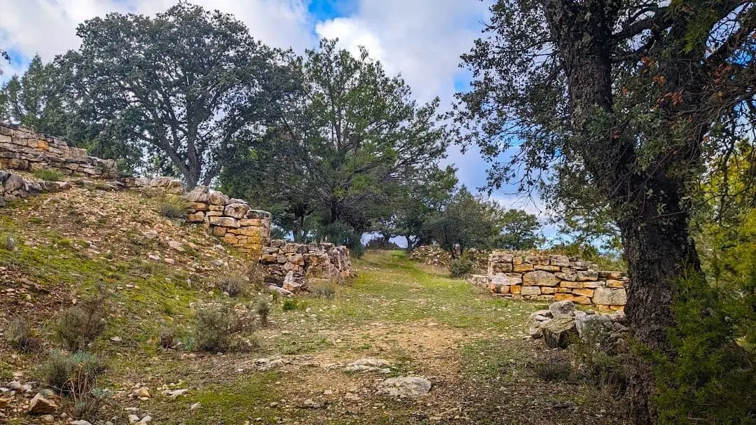
Photo: El Observario
A territory of watched hilltops
From Peña Moñuz, at the edge of Olmeda de Cobeta’s common pasture, you immediately understand why someone chose to live there twenty-four hundred years ago. The limestone spur, at around 1,240 metres, is protected by cliffs around almost its entire edge; only the remaining side needed closing. That is a castro: a small settlement on high, easily defended ground, from which people could see and be seen.
For much of the second millennium BC, Alto Tajo leaves barely any trace of permanent settlement. Around the 7th century BC, everything changes: fortified hilltop settlements appear, with cremation cemeteries beside them. Archaeologist J. Alberto Arenas interprets this as a process of settlement. Previously scattered communities begin saying this land is ours, and a hillfort visible above is their way of marking it.
Over time, some settlements grew into something else. In the Gallo catchment, Los Rodiles, at Cubillejo de la Sierra, exceeded five hectares, laid out streets in a grid and surrounded itself with three circuits of walls, the innermost built with large dressed blocks. Arenas believes such enormous defences were intended less to protect than to impress: the mark of a centre of power controlling smaller settlements. Excavated every summer since 2008 by María Luisa Cerdeño’s team and designated a Bien de Interés Cultural in 2012, it preserves a semicircular tower four metres high beside the entrance. Its two occupation phases document the clash with Rome during Celtiberia’s conquest. Nearby, in Chera, Prados Redondos, La Coronilla was among the first local hillforts excavated and published. Provincial studies cite it as a reference for understanding Celtiberian houses and walls.
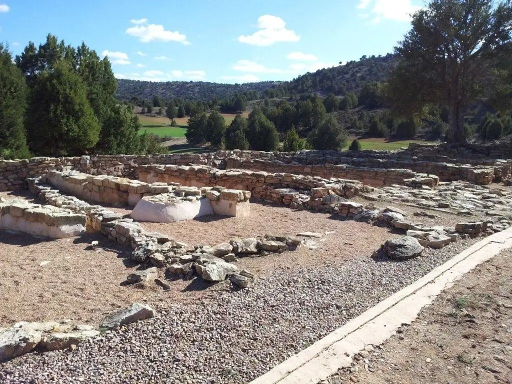
El Ceremeño: two villages, one above the other
In Herrería, on an isolated hill overlooking the valley of a Gallo tributary, stands El Ceremeño. Two settlements lie one above the other. The first, from the 6th century BC, ended in a fire; another was built over its remains and lasted until the 4th century. Houses stood on stone bases with rammed-earth walls, earth compacted between boards, a technique local villages continued using until the 20th century. On the town hall’s ground floor, a small museum displays excavation finds; hillfort visits are arranged by telephone.
Peña Moñuz: defence as architecture
Peña Moñuz, designated a Bien de Interés Cultural in 2012, is small but its three-layer defences are impressive:
- a field of upright stones, planted point upwards to break any charge;
- a rock-cut ditch, around five metres wide;
- a wall averaging around two and a half metres thick, reaching six metres in places, with three attached towers, each built using a different technique.
The first wall dates from the late 5th or early 4th century BC. In the 3rd and 2nd centuries the defences were remodelled, the southern gate closed and a new eastern gate opened, protected by a new tower. Inside, a large building contained many storage vessels and two domed bread ovens: perhaps in its final phase Peña Moñuz stored and distributed food for the surrounding area. It is reached on foot from Olmeda de Cobeta through a common pasture of centuries-old oaks.
Castil-Griegos: beside the livestock route
In Checa, on a hill around 1,474 metres high opposite Aguaspeña, stands Castil-Griegos, a hillfort from around the 3rd century BC. Small, with a wall and ditch, its houses lean against the wall around a central street. Beside it, a long-used cremation cemetery contained urn burials marked by stelae and stone mounds. It lies near a livestock route connected to the Cañada Conquense: grazing grounds and mountain crossings mattered long before the Mesta.
A hillfort near every village
The four best-known hillforts are only the beginning. Recent research speaks of castrification: from the Bronze Age to the end of the Iron Age, these lands were organised through a network of capitals, medium and small hillforts and fortified farms. Other sites in the atlas include:
- La Hoya del Villar, in Villanueva de Alcorón, excavated since 2021: a dry-stone wall, houses built against it and an entrance with an angled bastion and tower. It may have housed eight to ten families and contains material around 3,000 years old.
- Los Castillarejos, in Checa, from the 2nd century BC, with a rock-cut ditch and a cyclopean tower, a few kilometres from Castil-Griegos. Beside the river, Puente de la Sierra cemetery held around 250 graves.
- In Aragoncillo, El Palomar, its Cerrada de los Santos cemetery, and the watchtower and shelter at El Turmielo form a small, complete territory: living, watching and burying.
- El Castillejo de Anquela del Pedregal, with two enclosures and two periods, Late Bronze Age and Celtiberian.
- El Castillejo de Ocentejo, above the Tagus, already described by residents to Philip II: a tomb with a slab and stones bearing Latin inscriptions.
- The La Yunta cemetery, with 268 cremation burials from the 3rd century BC, among the eastern Meseta’s best studied.
- Valdeherreros-La Azafuera, opposite Los Casares cave, a Celtiberian settlement that experienced the transition to Rome.
- In the Ducado, in the Tajuña valley, Hocincavero and the Celtiberian town of La Cava, in Luzón.
Iron and war
Celtiberia was a land of metalworking. At Cueva del Hierro, in the Serranía de Cuenca, iron was extracted from around the 6th century BC. It provided tools and weapons famous throughout the Mediterranean and also attracted Rome.
Between 182 and 179 BC, the praetors Fulvius Flaccus and Sempronius Gracchus campaigned in Celtiberia. Archaeologists associate those campaigns with a destruction layer at Los Rodiles, the large oppidum at Cubillejo de la Sierra, in the northern Señorío. Alto Tajo’s smaller hillforts rarely became Romanised: they were abandoned or remained as ruins on the hills. Even so, the Geopark guide notes at least one site of Celtiberian origin near every present-day village in the Molina region. Today’s map of villages has Iron Age roots.
Visiting carefully
The practical situation is clear: today only two hillforts are properly prepared for visits, El Ceremeño and Peña Moñuz. The others offer little provision for visitors: undeveloped, barely signposted and difficult to understand on the ground, even where excavation continues. Do not pick anything up, move stones or climb walls: what looks like a pile of stones to a walker is, for archaeology, a document that can only be read once.
Vocabulary
- Castro
- A small fortified Iron Age settlement on high ground, with a wall and often a ditch.
- Oppidum
- A large Celtiberian settlement, almost a town, characteristic of the final period before Rome.
- Piedras hincadas
- A field of pointed upright stones before the wall to slow attackers, also called chevaux-de-frise.
- Rocky spur
- A projecting landform protected by cliffs on almost all sides.
- Cremation cemetery
- A burial ground where the deceased’s ashes were kept in an urn, sometimes with grave goods and beneath stelae or mounds.
- Rammed earth
- Earth compacted between boards to form a wall. Used at El Ceremeño, the technique survived into the 20th century.
Where to see it today
Celtiberian hillfort of El Ceremeño (Herrería)
Herreria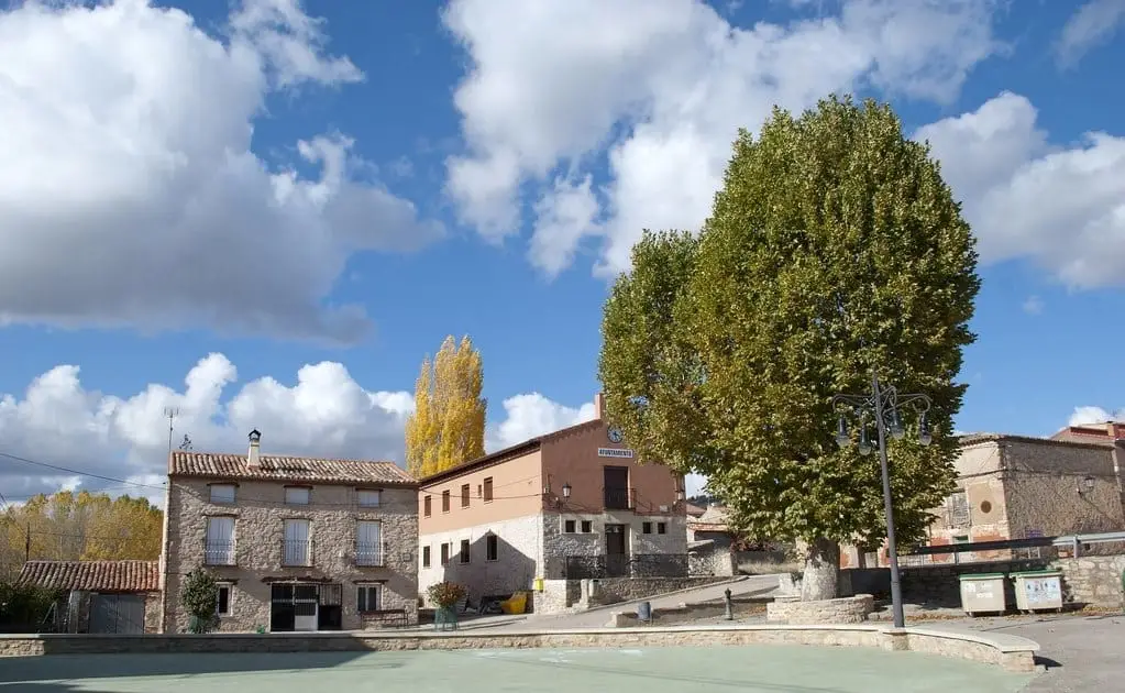
El Ceremeño Museum (Herrería)
HerreriaCeltiberian hillfort of Peña Moñuz (Olmeda de Cobeta)
Olmeda de Cobeta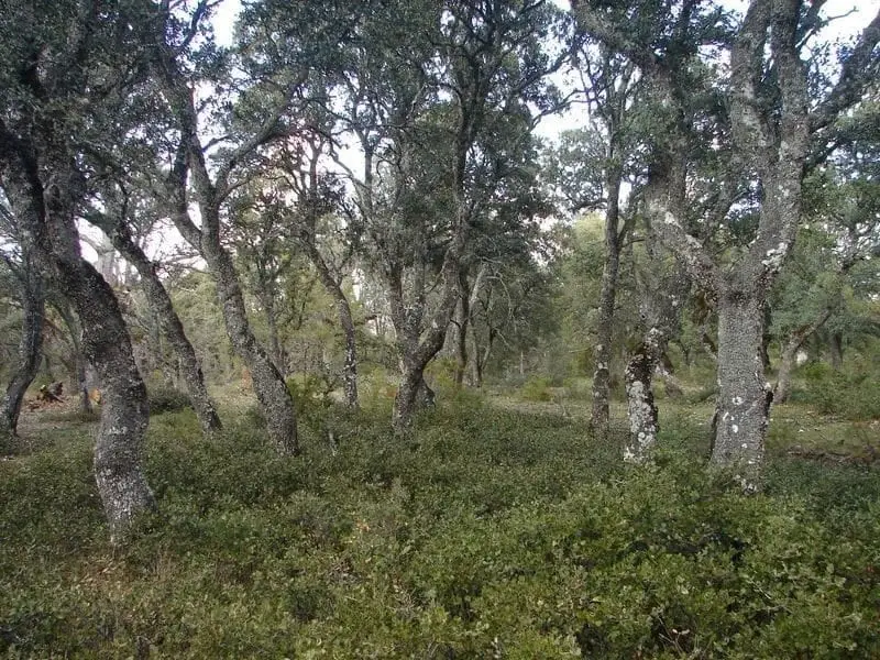
Dehesa of Olmeda de Cobeta: ancient pollarded Pyrenean oaks
Olmeda de Cobeta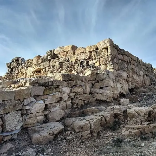
Castro de Castil-Griegos (Checa): Iron Age beside the Aguaspeña
ChecaCastro de Los Castillarejos (Checa): rock-cut ditch and cyclopean tower
ChecaLa Hoya del Villar hillfort (Villanueva de Alcorón): excavations in progress
Villanueva de AlcorónLos Rodiles (Cubillejo de la Sierra): an oppidum facing Rome
Cubillejo de la SierraCastro de La Coronilla (Chera): an excavated Celtiberian hillfort
CheraEl Palomar and Cerrada de los Santos (Aragoncillo): Celtiberian settlement and cemetery
AragoncilloEl Turmielo (Aragoncillo): watchtower and shelter of early Molina history
AragoncilloCastro de El Castillejo (Anquela del Pedregal): two enclosures upon a hill
Anquela del PedregalCastro de El Castillejo (Ocentejo): the hillfort seen in the days of Philip II
OcentejoCeltiberian necropolis of La Yunta: 268 graves on the Aragon border
La YuntaValdeherreros-La Azafuera (Riba de Saelices): from Celtiberian village to Roman vicus
Riba de SaelicesCastro de Hocincavero (Anguita)
Anguita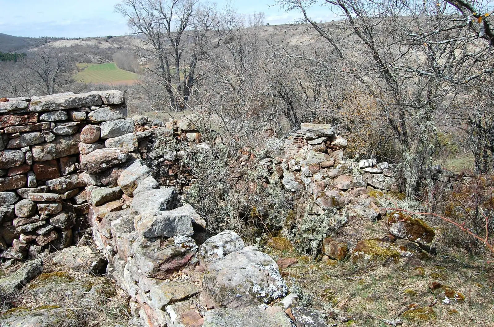
La Cava (Luzón): a Celtiberian town above the Tajuña
Luzón
The Aguaspeña of Checa: a living rock growing 4 cm a year
Checa
Roman mine of Cueva del Hierro: 2,500 years of iron mining
Cueva del HierroFrequently asked questions
Which Celtiberian hillforts can you visit in Alto Tajo?
Only two are properly prepared for visitors: El Ceremeño in Herrería, with a small village museum, and Peña Moñuz in Olmeda de Cobeta’s common pasture. The others, including Castil-Griegos and the large Los Rodiles oppidum, offer little visitor provision: they are undeveloped and barely signposted.
What are Peña Moñuz’s upright stones?
A belt of pointed stones planted in the ground before the ditch and wall, preventing attackers from approaching at a run. Together with the rock-cut ditch and a wall over two and a half metres thick, they form one of the eastern Meseta’s most complete defensive systems.
Who were Alto Tajo’s Celtiberians?
Iron Age communities of Celtic origin occupying the Iberian System. Classical sources mention large groups such as the Belli, Titti, Lusones and Arevaci in the area, although the affiliation of Alto Tajo’s individual hillforts is uncertain.
Sources and readings
- Arenas Esteban, J. A.: «El poblamiento prerromano en el área del Alto Tajo-Alto Jalón». Complutum, 22 (2), 2011, 129-146.
- Ficha de declaración BIC de Peña Moñuz (DOCM n.º 183, 18-9-2012) y proyecto «Olmeda: ecología y paleoambiente de las sociedades preindustriales de la cuenca superior del Tajo» (2014).
- Cuadernos de Prehistoria y Arqueología de la UAM, 41 (CuPUAM): fronteras y guerras celtibéricas (nivel de destrucción de Los Rodiles).
- Guía turística del Geoparque de la Comarca de Molina-Alto Tajo: Celtiberia, El Ceremeño, Peña Moñuz, Castil-Griegos, Los Rodiles.
- Ruta Celtibérica (catálogo): castros de la Serranía Celtibérica.
- Cerdeño, M. L., Sagardoy, T. y Chordá, M.: Los Celtíberos en Molina de Aragón. Los pueblos prerromanos de la Meseta Oriental.
- Cerdeño, M. L. y García Huerta, R.: El castro de La Coronilla (Chera, Guadalajara). Excavaciones Arqueológicas en España, 1992.
- Junta de Castilla-La Mancha: ficha del yacimiento del castro de Los Rodiles (BIC, 2012).
Further reading on the history of this land. Full bibliography.
Next story: The woods that fed people: charcoal, firewood, pollards, commons and hives